Friday, June 30, 2023

Grand Canyon Rim to River - June 10, 2023

Good advice

 Preparation

Our original plan was to run from the South Rim of the Grand Canyon down to the Colorado River and then up to the North Rim, and return the next day. Severe winter weather damaged the North Kaibab Trail and the need for repairs closed the last couple of miles of the trail below the rim.  In addition, the rock slides that damaged the trail also destroyed the water line to the Grand Canyon Hotel on the North Rim, closing it until well after our planned arrival on June 10.

We decided on doing a rim-to-river run from the South Rim instead, as we had flights and the hard-to-get South Rim hotel reservations in place, and it would still give us a change to see the canyon. Deferral risks never doing it.

Having no experience in running in the Grand Canyon, and only only one brief visit to the South Rim in 2017 we turn to others for advice as to preparation.

Ready to go!

Our Arizona friend Cathy has run rim-to-rim and rim-to-river in the past, and she enthusiastically agrees to join us and recruit others for the adventure. She provides invaluable advice as to preparation, including clothing, hydration, nutrition and equipment. I supplement that by joining several Facebook groups dedicated to hiking and running rim-to-rim in the Grand Canyon.

On South Kaibab.
(Photo by E. Burki)


Frequent running partner Emaad and I add some hill work to prepare for the descending and ascending that the run will entail - 4860 feet down South Kaibab Trail, and 4460 feet up Bright Angel Trail, according to the National Park Service, but there really anything we can do to replicate the Grand Canyon. We run once at Sugarloaf Mountain, and I spend some time on a treadmill at 20% incline, but it is more like a pro forma effort rather than a serious one.

The other parts of the preparation are serious. June 10 is summer at the Grand Canyon and temperatures at or above 100 at the bottom are the norm. So hydration involves a backpack filled with 56 ounces of Gatorade and two water bottles, each with 16 ounces of water for the start. Fuel is a waist belt filled with gels, shot blocs and various sorts of bars totaling 2000 calories. A long sleeve shirt, to provide warmth at the start (it can be chilly before sunrise at 7000 feet), then coverage from the sun later, and something to wet down during the climb out. A cooling towel, hat and handkerchief, to block the sun and to provide for wetting down for cooling. Trekking poles, to transfer weight from the legs to the arms during the ascent. Gaiters, to keep sand and dirt out of the shoes.

Hard to see South Kaibab switchbacks.
(Photo by E. Burki)

Down South Kaibab

Jim, with Cathy beside him, pick up Emaad, Kevin and I outside Maswik Lodge at 0445 and drives us to a trail near the turnoff near Yaki Point Road (closed to vehicles). Native American music plays in the car on the way, surprisingly both soothing and appropriate. We exit the vehicle and thank him, and walk the quarter mile or so to the South Kaibab Trailhead. The temperature is about 40 degrees, but doesn't feel particularly chilly.

Obligatory photos taken and restrooms used, we head down at 0504. I've brought a headlamp, but there is no need for it in the predawn light. We immediately head down a series of switchbacks as we move away from the rim. The trail is broad and smooth, without any of the rocks and roots that are endemic on eastern trials, but with steps that make developing a running rhythm difficult. Stopping to take photographs also disrupts the running, but we are here to experience the canyon, not to race.

We pass a Park Ranger headed up.  He had gone down in response to a call about a women in distress but whatever was the problem has been resolved.  Later, on Bright Angel Trail, we see signs warning hikers and tourists, "down is optional, up is mandatory."

O'Neill Point.

South Kaibab does not disappoint in that regard.  The descent is along a ridge into the canyon, so there are views in all directions. Ahead and below is O'Neill Butte, and then we skirt around it (about mile 2) and continue down. In another mile we are at Skeleton Point where we pause for more photos before descending another series of switchbacks.

Cathy and Emaad take in the
view on South Kaibab.

I chat with a hiker ascending the trail.  He is wearing a shirt remembering his deceased father, and tells me he has hiked down the trail in his memory, as it was something he loved to do.

A mile and a half later (and 900 feet lower) we arrive at The Tipoff where we take advantage of the toilet facilities. We chat we hikers whom we have been leapfrogging since leaving the rim. 

My legs are feeling wobbly. I'm not feeling dizzy or otherwise exhibiting signs of heat-related or stress issues and am not have trouble moving, but when I stop I'm having trouble balancing.  I take out my trekking poles which I was saving for the ascent, figuring they will be useful now.

Kevin takes off, and we will see him next at Phantom Ranch. Emaad and Cathy are pulling away from me, but the keep an eye out for me and occasionally wait for me to catch up to them.

Read the last sentence: "42 men . . ."
We finally spot the Colorado River far below, and marvel as to how we will get there.  But another series of steeper descents and switchbacks brings us toward the tunnel to the Kaibab Bridge.

Emaad and Cathy wait for me there, but before I reach them on the switchbacks, I slowly lose my balance and gently fall/sit on one of the steps.  I try to use my poles to stand, fail, and try and fail again. A hiker comes by and offers a hand to pull me up, which I gladly accept.

A Community Helps 

We were not the first here.

More picture taking and we cross the bridge. I stop to take pictures of Native American ruins and a sign commemorating the construction of the bridge.

Forty yards later I see Cathy sitting on the ground and blood running down her shin.  She had fallen and a rock had sliced an inch-long cut in her leg.  Emaad takes out his first aid kit, applies antiseptic and a gauze pad to cover the wound and stop the bleeding. But he doesn't have any tape to hold it in place.  We ask a passing hiker and he provides a roll of elastic open weave tape. Emaad wraps it around Cathy's leg, and then discovers that he left his mini-Swiss Army knife in his room. He tries to rip it with his teeth but that does not work.  We ask the next hiker if he has a knife and he produces one. First aid successfully completed, we go on to Phantom Ranch (mile 7.5), arriving about 0910, where we meet up with Kevin.  He has taken a soak in the Colorado River before going to Phantom Ranch.

Approaching South Kaibab Bridge.

After the traditional lemonade there, and spending several minutes sitting and snacking, I mail pre-written and stamped postcards so they can be carried out by mule (the only way to supply the camp). We top up our water and I add a lemonade to one of my handhelds. Cathy notes that the temperature is 90 degrees, an observation greeted with relief, as summer temperatures there routinely exceed 100 degrees. On the way down the trail, Kevin steps off the trail to soak in Bright Angel Creek.

We turn right to cross the other bridge across the Colorado and get on the River Trail.  Kevin takes off. (We won't see him again until we are having a bite to eat hours later at Maswik Lodge and he comes in clean, dressed and with his wife and son).

Cathy has warned us that the River Trail is largely level and sandy. I meditate that the river had deposited the sand there when its flow was free, before completion of the Glen Canyon Dam in 1963. We turn up a bit (every step up now is one less later, I think), but then descend again, meaning we will have to reclimb that bit again.  There are rafts on the river, and some are pulled to the shore below us.

Mules have the right of way.
(Photo by C. Blessing.)
After about a half mile we step aside for a mule train, headed by a pair of wranglers, on its way to Phantom Ranch. The mules ignore us and pass by.

Up Bright Angel

Finally (about mile 9.5) we reach the River Resthouse.  We refill our water, soak our hats, towels and sleeves in Pipe Creek and chat with the ranger stationed there.

Now it is time to go up.  My legs have entirely recovered - going up is easier than going down. Up we go. Bright Angel Trail follows the Pipe Creek drainage and crosses the creek several times, with us wetting ourselves down at every opportunity. 

(An aside here - why is this Bright Angel Trail?  Bright Angel Creek is at least a mile upstream and on the other side of the Colorado River. Bright Angel Trail follows Pipe Creek and Garden Creek. The trail that follows Bright Angel Creek is the North Kaibab Trail.) 

Every time we look up, the rim looks no closer, even after we have climbed 2000 feet in elevation. And it looks impossible to get there. There is a large red wall looming near the rim and yet another wall closer to us. Eleven miles in a series of switchbacks gets us up the first wall, and a steady uphill allows us to climb 500 feet over the next mile.

Up Bright Angel.

The next mile (only 200 feet of climb) gets us to Havasupai Gardens. As always today, we refill our water, soak our hats, towels and shirts, grab a bite and go on.

Since the trail follows the creek drainage, there are buttes are either side and the views are not as spectacular as those from South Kaibab Trail. Very good, but one has been spoiled by the earlier views, further enhanced by the early morning light. 

I've been lagging behind Emaad and Cathy and they have been waiting for me to catch up. Over the next 1.75 we ascend another 950 feet, including a series of switchbacks, to reach Three Mile Rest. The thermometer there reads 80 degrees at  about 1315. Gaining altitude (2300 feet since River Rest) is lowering the temperature. There is a pavilion, toilets and water there and I sit down.  A hiker strikes up a conversation about my Leki trekking poles, a brand he highly praises. Emaad grows impatient and is concerned that Cathy may be anxious if Kevin tells Jim about her fall and bloodied leg. I tell him to go on and not wait for me.

Bright Angel Trail.
(Photo by E. Burki.)

By now we are sharing the trail with day hikers. Cathy was playing "bad hiker bingo," filling squares with "person in flip-flops," "person without shirt," "person without water," and the like when she added a new one: a hiker blasting music from a Bluetooth speaker attached to his pack. 

Upward for another 1.5 miles, and more switchbacks (climb another 1000 feet), to One and a Half Mile Rest (16.3 miles at 1405). As always, refill the water, wet down, no hurry, look around at the views, play bad hiker bingo.

Almost done!

I fall in with a trio of hiker/campers and we exchange stories in mutual admiration.  I tell my usual well worn running stories (Emaad isn't their to roll his eyes at another rendition of "Ken's Greatest Hits") and they tell of their love of hiking and camping.  It almost makes me want to camp in the back country, but only if I could get someone to carry all my gear, pitch my tent and cook my food. And that would defeat the wonder of camping in a place far from others.

The last hour to the rim (another 1000 feet of ascent and more switchbacks) goes quickly. Stops to look back at the trail far below continue to amaze at the beauty of the canyon and the wonder of the journey - I was down there! How was that possible!

On the rim I find Emaad and Cathy (they were about 10 minutes ahead) and we recruit a tourist to take our picture at the iconic Bright Angel Trailhead rock. 

By the Numbers

About 18.1 miles in 10:07, according to my GPS.  NPS official distances: From South Kaibab Trailhead to Phantom Ranch, 7.4 miles. Descent from trailhead to the river, 4780 feet, then ascent of about 100 feet to Phantom Ranch. From there to Bright Angel Trailhead, 9.9 miles, ascent of 4460 feet.

My calves were trashed on Sunday, but still walked a couple of miles along the rim trail from Powell Point back to the village. On Monday ran 3.7 miles at Buffalo Park in Flagstaff.

Rim to River Complete!
(Photo by C. Blessing.)


Tuesday, June 6, 2023

Farm Park Challenge Marathon - May 6, 2023

A beautiful day for a run. 

We Live in an Imperfect World

Less than a minute into the first 5.1 mile out-and back-lap of the Farm Park Challenge Emaad says he forgot his water bottle. Which immediately reminds me that I did likewise.  We both retrieve our bottles at the beginning of the second lap.

Uncharacteristically, Emaad lags behind me on the first lap. As we pass each other on the out-and-back, he tells me that he isn't feeling well and will likely only do two laps.  In the second lap he says he'll do a third, and in the third, catches up with me.  But he knows his body and calls it a day after we finish the third lap together.

As I start to sweat on the second or third lap I'm reminded that I forgot to bring handkerchiefs to wipe the sweat off. My shirt will have to do.

Going to change my long-sleeve shirt at the end of the second lap I rummage in my bag and curse upon finding another long-sleeve shirt that I thought was a short-sleeve one when I packed it.  Fortunately I have another short sleeve shirt in the bag, but for some reason only packed one, rather than extra ones for changing on subsequent laps.

Who needs shoes if
you have ears and a tail?
Midway through the fourth lap I feel chafing on my left nipple. I didn't bring tape and don't have Vaseline along, so it could get worse. An inspired thought - I have lip balm with me. That works.

 Headed back on the fifth lap I spot a woman runner emerging from the woods. "It's a lot easier for you guys," she says as she heads onward.

At the end of the race I collect the beer glass that is the finishers' premium. But unlike previous years, there are no cans of beer to go with it. For whatever reason, the park hasn't granted the race the authority to hand out beer. But Mike offers me a non-alcoholic Athletic Brewing Upside Dawn and I sip it while sitting in his camp chair.

Bridges

The course has three small bridges to cross. Since the weather has been dry there isn't much water in the streams anyway, but the bridges do enable quick and dry crossings.  On the way inbound on one of the laps I notice flagging that indicates that the course wants the runners to go through the stream rather than take the bridge. I only see one person do that, and I use the bridge each time


First bridge

Second bridge

Third bridge


Stream crossing headed to the turn-around.
The Turnaround
The course has only only one small change from last year. The lap has been shortened by about 0.1 of a mile, making it marginally easier for those running the challenges. For the marathon, the final mini-lap has been lengthened accordingly. Also, the last bit of course veers left from Rock Creek Trail and crosses a small stream before the turn-around a hundred yards or so beyond.

Turnaround.

First lap by one of the fields.
Exceed Expectations

The challenge part of the Farm Park Challenge is to get through each 5.1 mile lap in less than an hour, then wait until the start of the next hour to run another lap in under an hour.  There are three challenges: three-, six- and ten-hours. The marathon does not require meeting the one hour per lap, pace, simply finishing 5 laps plus a bit of an extra out-and-back in ten hours.

I may be able to finish one lap in under an hour but that I could doing even three more is unlikely.  Although not necessary for the marathon I want to do the first lap under an hour. And I succeed - barely.  I get through the first lap in 59:51, a mere nine seconds to the good. (My subsequent laps are 64:56, 69: 28, 70:20 and 68:31, and 11:14 for the final .8 mile out-and-back.)

My finishing time is 5:44:27, good for 19 of 30 overall, 10 of 14 males and 1 of 2 in my age group. That is 40:53 faster than last year, when rain made the course muddy  It is only 2 minutes slower than 2021, on a slightly different, and likely slightly harder course.

Swag: shirt, glass, bib.


Monday, May 1, 2023

Gunpowder Keg 25K - April 15, 2023

Memory is Fallible
Several acquaintances from the Muddy Shoes group are gathered in the Bunker Hill Road parking lot at Gunpowder Falls State Park awaiting the start of the Gunpowder Keg 25K/50K.  I ran the race in 2011, although a somewhat different course, and they ask me about it.  I recall that much of it is along the Big Gunpowder River and isn't too hilly - just "some rolls" I tell them. This contradicts the race website which describes the course as "challenging" - but that doesn't seem to register with me.

Emaad before the start.

Emaad asks me if we had ever done it together, but I assure him that he was not with me in 2011, and my race report bears that out. It turns out that he ran one lap of three in 2007, on yet a different iteration of the course. Even after being reminded of that he has no memory of it, other than going to MacDonald's for French fries while waiting for two other runners to finish their second loop. He does not remember the "daunting hills, . . . rocky cliffs, [and] plenty of roots and stones to trip over," or his (twice) rolled ankle that Mark's race report recounts.

Instead, we are about to run on my false memory that the course is not particularly difficult.

A Non-Fat Ass Fat Ass
This is a low-key race.  Entry is $20 and runners are asked to bring a gallon of water or some treats for the aid stations.  There are no shirts, medals or any other sort of swag that accompany other races. It is a bit more formally organized that a typical fat ass run, in that it has an entry fee, minimal as it is, and it has manned aid stations. It will even have pizza at the end. A deluxe fat-ass.

The race director gives some instructions before we begin, reminds everyone to get a wrist band to prove they went to the out and back section of the course and sends us on our way.

There are about 130 of us who set out.  The weather is unsettled, and there is a high chance of showers.

We go down a couple of paved switchbacks, then up Bunker Hill Road before turning left onto the Bunker Hill Trail. We chat with a couple of runners - Jason, running his first trail race and Jenny (?, apologies for my forgetfulness if I have the name wrong) - before they and Emaad go on. 

Bridge at Masemore Road; aid station on left.
I clearly do not remember the course as I plod up the hills of the various trails.  Finally, after a long downhill the trail gets next to the Big Gunpowder River. I splash across Bush Cabin Run to the aid station at Masemore Road (about mile 4.6) and run a bit further upstream - until a left turn takes us onto the aptly named Highland Trail. How did I not remember this? Or was it not on the 2011 course?

Regardless, it is uphill, then a bit gently rolling on a gravelly fire road until we come to paved Falls Road, which we run down (quickly and smoothly for a change) to the level trail along the river and back to the Masemore aid station (about mile 7). 

We cross the bridge over the river and pick up the trail on the other side.  I'm running again with Jenny and we trade stories - her of her leaving teaching tech ed in a Baltimore County high school for a position at Goucher College and me of my current reading of Isaac Newton, the Last Sorcerer, by Michael White.  I tell of Sir Isaac Newton's work as Warden of the Mint at the time of the Great Recoinage (the Wikipedia article is wrong in myriad ways - see my article, Sir Isaac Newton served mint as warden, master in the September 11, 1995 World Coin News.)

Rocky trail to left; small stream to right.
We nearly make a wrong turn but Jenny keeps us on the trail.  We cross under I-83, make a left onto York Road to cross over the river, visit the York Road aid station (mile 9.4) and head across the road to run a loop initially along the river east of I-83.  Jenny pulls away and I'm left to run alone again. I cross a small feeder stream, and come to the T-intersection where a sign directs me left. I go to the end of the out-and-back near Big Falls Road where I collect my wrist band (about mile 12) to prove that I was there.

Trail Angel
As I return to the T, there is a runner just crossing the stream.  I remind him that he needs to go left to collect his wristband.

He holds up his arm. "I already have it," he says, I made a wrong turn and ran the loop a second time."

Clay is running without a water bottle or nutrition and is not looking in good shape. To add to his problems we are on the Panther Trail, which follows the small stream we crossed, and it is uphill.  

I offer him a gel and some water. At first he declines but I assure him I have several and can spare one.  Finally he agrees and eats it.  I squirt water in his mouth to help wash it down.  We mostly walk on and I assure him that I'll stick with him.  After a bit he asks for more water and I oblige.

Smoother than usual trail.
(Photo by E. Burki)

At the top of the climb he says he knows where he is and heads for a shortcut back to the York Road aid station. 
 
Trail Angel II
In a little while I come upon Jason.  He is limping along.

"How are you doing, dude?" I inquire.

"Cramping up," he says, "Anytime I try to run my inner thighs cramp."

I've experienced that and know that it is painful. "How about a salt tablet," I offer, "It should help."

He takes it with thanks. He's also out of water.  I offer some but he declines as we are not too far from the York Road aid station (mile 14.8).

We review what he had done during the day.  As a first time trail runner he has made a few mistakes - not refilling his pack at the aid stations, not eating at the aid stations. He didn't realize that he could get refills. When we get to the aid station he corrects both errors.

While he is getting a refill I fill my bottle, drink some cola, grab some chips and candy and go on. A short stretch along Big Gunpowder leads to a steep 300-foot climb away from the river.  And then a descent back to the river. A short stretch leads to the morning's paved switchbacks, but the return course skips the final one, and I get back to the start-finish in 4:20:11.  This is under the 4:30 cutoff to start the second loop for the 50K, but the race allows the option of stopping after one loop for a 25K finish, and I take it.

Emaad had finished the loop in 3:40:29. Jason is about 8 minutes behind me. Clay, I learn later, dropped, probably at York Road. Overall I was 92 of 106 25K finishers, 65 of 72 males and 1 of 2 in my age group.  Only 22 people finished the 50K

Epilogue
Emaad and I stop at Hysteria Brewing and the attached Bullhead Smokehouse in Columbia for food and refreshment on the way home.  While we are there there is a downpour and then another on the drive home.  We consider our good fortune in not doing the second loop.

My GPS reports nearly 1800 feet of climb over 16 miles of course.  So much for not remembering any climbs from the previous time.

Swag: Wrist Band, recycled bib.

Friday, March 24, 2023

Seneca Creek Greenway Trail Marathon/50K Marathon - March 11, 2023

Waiting
I wait until 18 hours before the race to register as I track the weather for the Seneca Creek Greenway Trail Marathon/50K. Some rain on Friday, but Saturday's forecast calls for temperatures in the mid-30s to near 50 with blustery winds, but no rain.  There is no increased registration fee as the day draws closer, the race is well under its capacity and the registration cut-off is a half hour after the start, so no reason to hurry to sign up. I'll run if  the course is muddy, which it often (see my 2019 and 2014 reports), but I won't run in cold rain (unless in Madrid).

Waiting to start

Running

The 230 or so runners gather at the Nut Hatch Pavilion in Seneca Creek State Park for the start and at 0730 we are off down the park road.  That helps spread out the field a bit before the turn onto the single track of Long Draught Trail to head south.

The pace is easy and it is a change to become acquainted with one's fellow runners. As we merge onto the Greenway Trail I get chatting with two runners who ran Rim-to-Rim-to-Rim in the Grand Canyon last September.  It is an excellent opportunity to get a briefing on the iconic crossing that I plan to do in June, although the plan is to cross from the South Rim to the North Rim, overnight there, and return the next day.  The two runners did it all in one day.

Inevitably they pull away from me and I run along chatting with others.  The pace is easy and the trail is in excellent shape without mud to speak of. Temperatures are in the upper 30s and the day is a blustery, but the wind largely does not penetrate the woods. Only when the course is along fields is the wind felt, and I take my hat on and off several times as the day progresses.
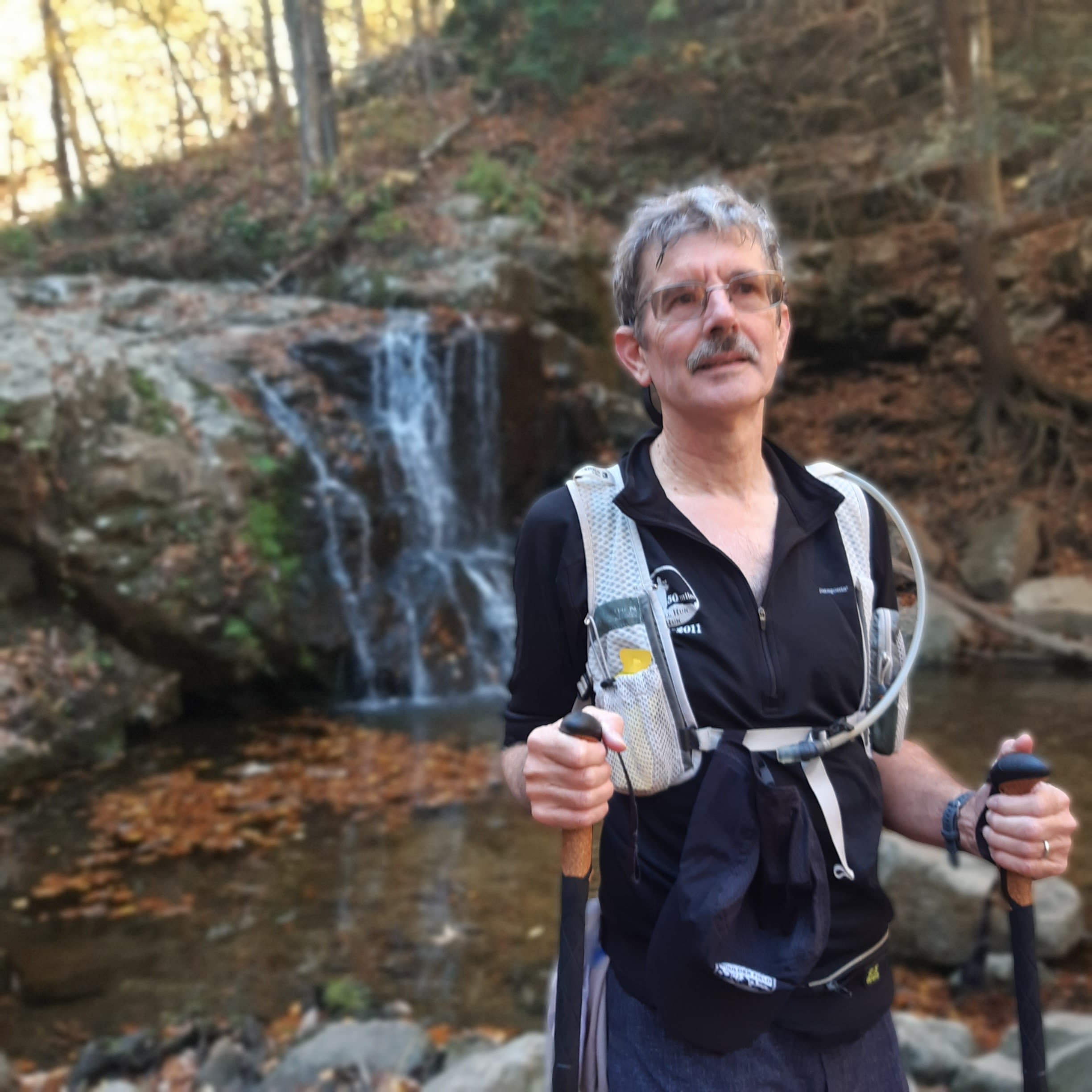
Volunteers at the Route 28 Aid Station

A pass through the Route 28 aid station (about mile 8) leads to a crossing of the bridge over Great Seneca Creek to the Seneca Bluffs Trail on the west side of the creek. Before long there is a large tree that has been uprooted and toppled across the trail and it requires a bit of scrambling to get around. The forest does not seem particularly vibrant to me, as there is thick undergrowth everywhere, and vines climb on nearly every tree.

Seneca Bluffs Trail - Note vines strangling trees
Crossing Dry Seneca Creek is not a problem for me this year. The stepping stones across the creek are well above the creek and I don't suffer from the hesitancy that I had last year. The reach to the first stone seems a bit daunting but I don't hesitate to take the first step into the shallows by the bank even if it results in one wet foot.

Trail Marker
After finishing Seneca Bluffs Trail and crossing over Great Seneca Creek on River Road (mile 13.5) I look forward to the very unofficial aid station just before turning onto the Greenway Trail. But the aid station is not there! No adult beverages for fortification! Alas! 

So on I go to toward the aid station at Berryville Road (mile 15). Fewer runners out here now.  A woman passes me while I make a phone call, then I pass her back while a pair of males pass us. Getting to Hooker's Branch just before Berryville Road I spot one of the guys trying to maneuver across the stream. I'm feeling light footed and not particularly concerned about getting wet (I have shoes and socks in a drop bag at the aid station if needed). I bound from rock-to-rock and am almost upon his back when I tell him to keep going.  One foot gets a bit wet but I'm unconcerned.

I grab some chips and M&Ms at the aid station, miss the peanut and sweet pickle sandwiches, ignore my drop bag and go on.  I run the entire section back to the Route 29 aid station alone. Occasionally trees creak in the wind and I wonder if they will topple, but the fear is unfounded.

DNF: Upside down and in a tree (miles 7.5 and 19.7)
At the aid station I drink a cup of Coke, get a handful of chips and go on. I pass, for the second time of the day, the upside skull.

Emaad is waiting for me at Black Rock Mill (mile 21). He has agreed to pace me to the finish.  The section on the Seneca Ridge Trail from there to the aid station at Riffle Ford Road (mile 26.8) is one I do not particularly enjoy.  I just seems long and lacks any significant landmarks.

The Santa Mariachi Shrine
Except one, For years the Shrine of the Santa Margaritas has been a welcome sight.  There are rumors that the shrine has been desecrated and is no longer there. But it is there! And perhaps better than in the past.  The saints are wearing new hats and the decorations look fresh.  Later I learn that the acolytes and tenders of the shine (Anton and ML) have restored it to its former glory.  Indeed, better than its former glory, for it now has six, rather than the former five, saints.

Having paid our devotions at the shrine we proceed. We are now in the company of another five runners, with whom we leapfrog, sometimes ahead, sometimes behind. One is a solo woman runner, and the other two are two pairs of men (waggishly described by Emaad as "the CrossFit guys" and "the Marines").  

Stream crossing near Riffle Ford Road
(photo by E. Burki)

We are following the red-blazed trail but slowly become aware that we have not seen any of the blue flagging that marks the course. We realize that we haven't seen any since leaving Black Rock Mill.  At one point we come to a trail intersection and I plow ahead, but Emaad calls me back. The other runners catch up and there is a brief debate as to the way to go, but the consensus is to stay on Seneca Ridge Trail and follow its red blazes. As we proceed I alternate between "this is familiar" and "this is the not the course."

But finally I settle on "this is familiar" and in a mile or so we reach Riffle Ford Road and the aid station (mile 26.8). 

In another mile or so we reach the decision point where one chooses whether to go left to the finish for the "at least a" marathon or go straight for the loop around the lake for the "at least a" 50K.  I'm feeling good, and we are at least 40 minutes ahead of the cutoff for starting the 50K loop. Most times this would be a no brainer and I'd go straight.  But I don't really like the lake loop and don't feel any desire to do it so I elect for the left turn to the marathon finish.

Results
My GPS reads 29.3 miles, about 1.2 miles longer than the GPS reading in 2021.  The course seemed the same except for the unflagged section, which may have led us astray.  The GPS tracks from 2021 and 2023 appear to be about the same.  Another runner who dropped out at the Riffle Ford Road aid station had 28 miles to that point, consistent with my finishing distance and the longer distance this year.  In any case, it is what the race director says it is.

I finish in 7:11:48, good for first, last and only in my age group. I'm the oldest finisher and 63 of 80 overall and 50 of 59 males. There are 117 finishers in the 50K.  I collect my wooden coaster finishers' award and a couple of bagged snacks. Then I drive Emaad back to his car at Black Rock Mill and we go off to enjoy a beer and bite to eat.

Swag: bib, wooden coaster


Saturday, December 31, 2022

Colossal Vail 50/50 55 K - December 10, 2022

Photo by Jim Porter (www.jimporterphoto.com)

Return to the AZT
Three years ago Emaad and I ran the Colossal Vail 50/50 50 mile race.  We returned in 2022 for the 55K on December 10.  The entire course is a double out and back on the Arizona Trail, and the 55K is the southbound part of the course, so we know what to expect.  The only difference is that the race has moved from November to December and the temperature at the start promises to be chilly.

Visiting the Desert Museum with Cathy

Eco-tourism
The day before the race we meet up with Arizona friend Cathy, who is an avid gardener and runner at the Arizona-Sonora Desert Museum.  She gives us an enthusiastic tour of the outdoor facility where we can view not only desert plants, but many of the animals who inhabit the Sonoran Desert, which stretches to the Gulf of California.  The museum also tells how the Tucson area was once home to grasslands watered by riparian waterways, but the arrival of settlers with overgrazing cattle and water diverting plans led to the spread of desert plants in place of the grasslands.  Cathy runs the half marathon at Colossal Vail, but because that race starts well after ours we do not see her. She finishes second in her age group even while stopping to take pictures along the way.

At the start.

Preparation
I sleep fitfully the night before. I continually worry about being able to make the final cutoff at the final aid station. Also, I worry about the temperature swing. Will I dress for the cold and then regret it as the weather warms up?

Start
We arrive at the start in plenty of time to see the four dozen or so 50-milers take off 15 minutes ahead of us.  Then it is our turn and we are off.  I've dressed for the cold - two long sleeve shirts, gloves, hat, buff and tights. The race starts with a long climb of about 300 feet that helps string out the approximately 80 entrants.

Cresting the ridge we head downhill. After about a mile Emaad takes off.  I don't try to follow.  I chat with some other runners, including a 50 miler who has dropped down to the 55K because he has a holiday party to attend later.

Soon enough I'm pretty much running alone.  I take a gentle fall and land pretty much unscathed. Further good fortune, there are no cacti where I land, especially the dreaded cholla, or jumping, cactus.  I'm up and underway in no time.

Saguaros on the course.
We pass under the railroad trestle over Davidson Canyon and then descend into the canyon itself.  There had been rain the previous week, and the creek has water in it that requires some judicious stepping to keep feet dry.  I only partially succeed and manage to wet one foot.  And the water has a certain fragrance that reminds me that there are probably cattle grazing somewhere upstream.

Gabe Zimmerman Aid Station
A slight climb leads out of the canyon and to the first aid station at mile 4.9.  The aid station is located at the Gabe Zimmerman Trailhead,  named for Gabe Zimmerman, the community outreach director for Rep. Gabrielle Giffords. He was one of six people killed on January 8, 2011, when a gunman shot the Congresswoman and 18 other persons outside a Tucson Safeway at a “Congress on your Corner” event.  He liked to hike, run and mountain bike in the Tucson mountains and contributed to the completion of the Arizona Trail and his father and friends helped get him memorialized in a place he loved to visit.

The tunnel under I-10.
Southward
In about a mile and a half we go through the snake tunnel under I-10. The course rolls a bit as it heads south and then southwest, crossing the Old Sonoita Highway and then in a bit crossing under Highway 83.

By now we have left the range of the majestic saguaro cacti and have only lower varieties to see.

Time for a Change
Reaching the Sahuarita Road Aid Station (mile 11) manned by superheroes ("We were going with a Marvel theme," I'm told, "but then Mrs. Incredible came, so we went superhero."). I sit down and get my drop bag.  It has warmed up enough (frankly, warm enough at Gabe Z AS) to switch my two long sleeve shirts for a fresh one, get rid of my hat, gloves and buff, change the (one) wet socks and try to stay modestly covered while I take off my shorts and tights.  A towel helps. I note a scape on my knee from my fall and get a alcohol wipe to clean it. I joke that I fear contracting necrotizing fasciitis, but decline to offer of a band aid.

Gate on the trail.
Follow the AZT!
And It is Officially a Trail Race
 Going onward, I monentarily lose the trail. But having been here three years previously I realize that the jeep road I'm about to go on is not the AZT, backtrack ten yards and pick up the turn I had missed. Since "it isn't a trail race unless you fall down or get lost'" I have now checked both boxes.  And I still have another 20 miles or so to go.

The course climbs another 500 feet or as it heads to the ridge crest before dropping down to the Peaks View Aid Station (mile 17). About a mile from the aid station I meet Emaad coming toward me.  We exchange greetings and he tells me that only only about 20 minutes behind him.  Thinking about it I recalculate what he said and figure he meant I'm 20 minutes from the aid station, or 40 minutes behind.

Turn-around
After using the primitive facilities at the aid station (imagine a child's potty chair surrounded on three sides by a blue tarp flapping in a breeze) I head north.  Although I had applied sunscreen at mile 11 I regret not having grabbed a cap.  The sun is getting warm.

After topping the crest, I enjoy the opportunity to run the long and mostly gentle, mostly rock-free downhill.  I feel like I'm making good time.

I spend a lot of time walking during ultras. My GPS will say that I walked half the time during this race. I walk the uphills, I mostly walk rocky or rooty sections, and I walk steep downhills. And I walk if I feel tired. So a chance to run for a seemingly long stretch is uplifting.

Back at Sahuarita Road Aid Station (mile 23.6), I change shirts again, this time putting on a short sleeve shirt and remembering to take a cap.  I chat a bit with a runner who has dropped out due to a hip injury and another runner, who I had passed just before the aid station comes in and announces that he, too, is dropping out.

Facing the Cut-off
I had prepared a pace card so I knew what times I needed to keep up to make the cut off at Gabe Z in-bound.  But I had lost it, and would have to rely on being able to calculate time and distance, something ultrarunners know is difficult to do on a tired brain.  I had a back of the envelope calculation that I was in good shape, but one is never certain. A fall, a rolled ankle or a wrong turn can lead to failure.

I go on and after a bit can see I-10. Cross under it and Gabe Z is only a mile and a half away.  But it never seems to get closer. Maybe I'm looking at it on the diagonal.  Maybe the trail is veering at an angle. But finally the trail drops down to the tunnel and I'm through.  A glance a the watch shows that time is not a problem.
In the distance I can see another runner.  Sometimes I seem to be getting closer, but just a soon she pulls away.  The final stretch to the aid station (mile 29.8) seems to take forever but I arrive there with plenty of time to spare.  I plunk down in a chair while the helpful aid station workers (dinosaur theme at this aid station) refill my pack, soak my bandana with cold water and generally treat me royally. Now my only concern is getting to the finish before sunset as I don't have a light other than the flashlight on my phone.
Union Pacific railroad bridge (about miles 3.8 and 30.9) 
Home Stretch
Shortly after leaving the aid station I catch up with Judi.  She is signed up for the 50 miler, but has decided to drop down to the 55K. (The race allows 50-mile runners the option to take a 55K finish rather than continuing on to the northern out-and-back when they return to the start-finish area.)  We go along together, chatting and trading stories of races we have done, including one we both did in different years.

Food at the finish, with finisher's spike. 

Approaching the finish as we cross dry Agua Verde Creek we hear the announcer getting the three dozen entrants in the night half marathon ready to start. If we don't get to the finish quickly they will all be coming at us on on single track.  I urge Judi and another runner we have caught up to on. The half marathoners see us coming and cheer us to the finish, less than two minutes before they start.

Results
Emaad is at the finish, having finished in 8:29. I finish in 9:43, good for 72 of 79 overall; 48/51 males and 3/3 in my age group.

I enjoy the BBQ sandwich, macaroni salad, potato salad and a beer before we head out.

Swag: Shirt, bib, finisher's spike,
AZT socks and sticker, Huppy bar.

Monday, November 21, 2022

Patapsco Valley 25K - October 29, 2022

Back to Running
I fractured a bone in my left foot on July 11when I missed a step in the house.  No surgery was necessary, but I spend eight weeks in a cast, which didn't come off until September 14.  While I could walk, I didn't resume until October 3 when I managed four miles on the treadmill. From then I ran nearly every day, usually 3 - 6 miles per day. Uncertain of my stability on trails, I bought a pair of Leki trekking poles.

Emaad had signed up for the two-loop Patapsco Valley 50K on October 29.  Looking at the course map I recognized that I have run on much of it while running the Maryland Heat Runs in 2015 and 2019. While it is nice to know what the course offers, in this case I know it offers plenty of steep up and downs. I know that I'm not in shape to take on the 50K, but one loop for 25K with a generous cutoff seems doable, particularly with trekking poles.  I sign up.

I get one ten mile run on trails in with Emaad on October 23. It's a chance to get used to the trekking poles. 
Typical Single Track

Race Day
I drive Emaad and myself to the race start at Baltimore County Community College on the edge of the the park.  The weather is just about perfect - maybe a tad warm.  We chat with fellow runners and he goes off with the 222 50K runners at 730.  The 25K starts an hour later. I chat with friend Gretchen as we wait, and once we are off she is quickly gone.

We run a few hundred yards on a grassy field before getting on the single track trails in the park. It is a bit of up and down, but mostly down, as we need to wind up at the Patapsco River before crossing over to the other side of the valley.

As time goes on the runners spread out and I move further back in the field. The poles help on the steeper rocky and rooty downhills, and at one small stream crossing, save me from slipping from a rock.
Tunnel under train tracks (Mile 6)

Memories of the course come back from the Maryland Heat Races although we are largely running the trails in the opposite direction. After about 3 miles there is a water-only aid station, but my pack is pretty full so I thank the volunteer and go on.

Near the river we cross under the railroad tracks and in a short while come to the first full-service aid station.  I get my usual fill of cookies and M&Ms and eat them while going on.  

We cross the river on a road, pass the Avalon Picnic Area (start-finish for Maryland Heat Races) and turn uphill on the trail.

Plenty of climbing and descending small valleys are in store, but I'm in no hurry and am mostly walking anyway.
John Smith Marker (about mile 8)

On top of a ridge overlooking the river I stop to look at a monument by the side of the trail.  "Capt John Smith" on one side, and "to the cross hath been discovered A.D. 1608" on the opposite.

I'm a bit confused as are several other runners. We are a couple of hundred miles from Jamestown, Virginia. the only thing I know about John Smith is the story about Pocahontas. While much about that story is unclear, disputed or romanticized (or all three), it turns out that Smith did visit the place where the monument sits. 

A year after arriving in Virginia, Smith extensively explored and mapped the Chesapeake Bay, apparently looking for a passage to the Pacific Ocean. The Captain John Smith Chesapeake National Historic Trail follows his journey, including his visit up the Patapsco to that site.
Cascade Falls (mile 10)

Onward I go (plod?).  I pass the log by a now-dry intermittent stream crossing where I lay down during the 2019 Maryland Heat Race to recover from the heat. (That picture is worth a look if you want to see what not-fun running looks like.)

Downhill leads to the picturesque Cascade Falls. There are two photographers there, both with cameras on tripods, on either side of the pool. I wonder why they chose the side they did.  Many other people are also taking pictures at the photogenic location and I can't resist either, asking a fellow runner to take mine. 

Crossing over the stream outlet of the falls to get to the trail on the other side requires navigating over medium size rocks.  Near the end of the rocks a father is helping his pre-teen son get from rock to rock while his mother and a couple of other children wait. The father is describing the rocks ahead and instructing the son where to feel for his next step.  The boy reaches out with his rubber tipped stick and feels the contours of the rocks.  He is blind. Courage, trust and love are together in that moment.
 
In half a mile I get to the next aid station, refuel with some bacon and candy and return to the trail for more up and down.

Ahead of me are "Tweetle Dum" and "Tweetle Dee," a pair of women with matching shirts with the afore-mentioned logos on them.  I press to keep up with, and even catch up to them.  We pass a large group of women out walking all wearing matching shirts proclaiming their support for abused women.  One has fallen, and some of the others are gathered around her, but she isn't hurt and doesn't require assistance.  There are two hikers that I repeatedly pass, and they repeatedly pass me, when I stopped at the falls, and the aid station. 

I finally catch up to the Tweetles, as I dub them, around mile 12, and see Gretchen just in front of them. Another runner, Nicole, is with her.  Mercy sakes alive, looks like we got us a convoy! 

Along the Bloede Dam Trail, to a right on Ilchester Road, another right past the second water-only aid station, across the Patapsco Swinging Bridge onto the paved Grist Mill Trail and a sharp left back onto the trail.  We are headed away from the river, so it is uphill. And more uphill.

We pass Ilchester Rocks, where rock climbers practice their skills (although there are none today), It's then a long downhill on the Sawmill Branch Trail, where there is a very steep boulder drop that requires me to go bottom first, and then a 300 foot climb out.

Somewhere along here Gretchen and I decide that we should finish together. Maybe it is a way to bank any competitive fires we have, or a mutual decision to be companionable, or a mutual decision to be compassionate. In any case, even as we leapfrog a bit we stay together. We come out of the woods together, and as we cross the field we join hands and cross the finish line together.

Post-Race and Results
I finish in 4:49:24  for 162/186 overall, 106/114 males and 1/2 in my age group.  Gretchen also wins her age group, even though there are no prizes.

Waiting for Emaad I go off to Subway and get a foot-long which I devour without any problem. Picking him after his 50K finish we go off to Hysteria Brewing Company for some refreshment.

Swag: Shirt, tote bag, magnet, bib and medal